|
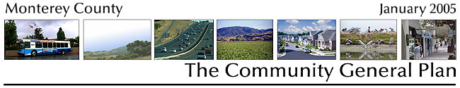
Introduction
In many ways, the Land Use Element is the most “basic” of all of the required elements of the local General Plan. This Land Use Element is specifically based on the Twelve Guiding Objectives, and six of these Guiding Objectives are particularly applicable:
Guiding Objective #2
Identify land that is adequate and appropriate for the residential, commercial, and industrial development needs of Monterey County during the next twenty years, taking into account land located within the cities, existing legal lots of record, and resource and infrastructure constraints.
Guiding Objective #3
Preserve a distinction between urban and rural areas. Channel new growth to areas already committed to an urban level of development (e.g., cities, areas directly adjacent to cities, and densely developed unincorporated communities). Preserve rural industries (e.g., farming, livestock grazing, mining), natural resource protection, and open space recreation uses.
Guiding Objective #5
Promote the development of walkable communities that meet the daily needs of their residents, offer a high quality of life for their residents, and reduce the need for automobile trips.
Guiding Objective #7
Minimize development of commercially viable agricultural land. Ensure that recognized needs for growth are met by infill and contiguous, compact development.
Guiding Objective #12
Provide a clear statement of county land use values and policies to provide clarity in the county’s permit processing system and to simplify review of projects that are consistent with the General Plan.
Guiding Objective #1
Preserve the unique character of areas throughout Monterey County as represented by the different Area Land Use Plans.
Based on these Guiding Objectives, this Land Use Element:
- Provides areas specifically set aside for residential, commercial, and industrial development, both through written policies that are part of the Element, and through the maps made part of the General Plan, The Land Use Element also ensures that there is adequate residentially-designated land to accommodate the growth projections for Monterey County that have been prepared by the Association of Monterey Bay Area Governments (AMBAG), which is the designated regional agency responsible for making such population projections.
- Focuses new growth and development in designated Community Areas, as directed by Guiding Objective #3, and directs that the character and quality of this development is consistent with the standards spelled out in Guiding Objective #5.
- Helps preserve commercially productive agricultural land by directing new development to Community Areas, as required by Guiding Objective #7.
- Makes the policies of the Land Use Element as “clear” and straightforward as possible, consistent with Guiding Objective #12, so that property owners, project applicants, members of the public and county staff all know what land uses are desired, where.
- Last, but not least, the Land Use Element complies with Guiding Objective #1 by specifically requiring that development projects in Monterey County be approved only when they are consistent with the vision statements and special policies applicable in each of the County’s designated Planning Areas.
Land Use – Goal #1
PROVIDE A LAND SUPPLY TO MEET THE LONG-RANGE (20-YEAR) AND SHORT RANGE (5-YEAR) POPULATION GROWTH TARGETS FOR MONTEREY COUNTY, WHILE ENSURING THAT THESE GROWTH TARGETS DO NOT EXCEED THE COUNTY’S FAIR SHARE OF STATE AND REGIONAL HOUSING GROWTH, AND THAT NEW GROWTH IN THE UNINCORPORATED PORTIONS OF MONTEREY COUNTY DOES NOT EXCEED THE CAPACITY OF AVAILABLE INFRASTRUCTURE OR DAMAGE THE ENVIRONMENT. |
Land Use – Policy #1
Provide An Adequate Land Supply – The County will provide a land supply that will meet the long range (20-year) and short range (5-year) population growth projections for Monterey County, as established by the Association of Monterey Bay Area Governments (AMBAG).
Land Use – Policy #2
Meet Population Projections By Growth Within Community Areas – The County will meet its long range and short range population growth projections by directing new urban development to the unincorporated Community Areas of Boronda, Castroville, Pajaro, Chualar, and Fort Ord, where adequate level of services and existing sewer and water supply can be provided. In combination with existing legal lots of record, urban development in Pajaro, Castroville, Boronda and Fort Ord will accommodate the full 20-year population projections for the unincorporated portions of the County. Development of Chualar will provide additional land for development beyond that needed to accommodate projected population growth.
Land Use – Goal #2
PRESERVE A DISTINCTION BETWEEN URBAN AREAS AND RURAL AREAS.
|
Land Use – Policy #3
Major Land Use Classifications – To preserve a distinction between urban areas and rural areas, all lands within Monterey County shall be classified in one of five Major Land Use Classifications, as shown on Map 2 and as listed and described below:
- Cities
- Community Areas
- Rural Lands
- Agricultural Lands
- Public Lands
Cities
Cities are defined as incorporated geographic areas. Wherever practicable, future residential, industrial, and commercial development in Monterey County shall occur within city boundaries where infrastructure is available to accommodate growth and away from rural areas where agriculture, natural resources, land-dependent resource activities, and open space recreation predominate. The County shall actively work with the cities and LAFCO to promote orderly, efficient, compact, urban development patterns as cities expand into unincorporated areas to accommodate future growth.
Community Areas
Community Areas are defined as unincorporated lands that are served by, or will be served by, a full range of urban services. Planned Community Areas are the unincorporated communities of Pajaro, Castroville, Boronda, Chualar, and Fort Ord. Prior to Redevelopment and Community Area Plan adoption, land use designations within Community Areas are: CA-residential; CA-commercial; CA-industrial; CA-Resource Conservation. Where a redevelopment and community plan has been adopted, land use designations in these plans shall apply to the Community Area.
Rural Lands
Rural lands are limited to low density residential development and estate lots, small-scale farming and grazing and mineral extraction, and small groupings of visitor-serving uses or commercial businesses that serve the local area. These areas do not have adequate public infrastructure and services to accommodate further subdivision or intensification of land uses on existing lots beyond the one single family home, accessory structures or existing small scale neighborhood serving commercial uses.
Agricultural Lands
Monterey County’s largest industry is commercial agriculture. Lands designated as “Agricultural” are, in fact, a special type of “industrial” land. They combine the best soils, favorable growing climate, large landholdings, and generally adequate water supplies. Because of these factors, “Agricultural” lands are uniquely able to support long-term commercial agricultural production, ranging from intensive row crop farming to less intensive livestock grazing. Because these lands are at the foundation of the local economy, they are given strong protection in this General Plan.
Public Lands
Public lands are public or quasi-public lands, including military bases, wilderness areas, national forests, state, county and regional parks, public institutions and other open space.
Land Use – Goal #3
DIRECT NEW GROWTH IN THE UNINCORPORATED PORTIONS OF MONTEREY COUNTY INTO DESIGNATED COMMUNITY AREAS.
|
Land Use – Policy #4
Development Directed to Community Areas -New urban development shall be directed to the unincorporated Community Areas of Boronda, Castroville, Pajaro, Chualar, and Fort Ord, where an adequate level of services can be provided, where there is an existing sewer system and water supply, and where development can take the form of walkable communities that meet the daily needs of residents, balance jobs and housing, offer a high quality of life, and reduce the need for automobile trips.
Chualar shall be designated as a Community Area for the purposes of allowing growth that will enhance the existing community, provide housing affordable to residents and workers in the area, and improve and increase services, while maintaining Chualar’s small town character.
The urban development boundaries of Pajaro, Castroville, Boronda and Fort Ord are shown in Map 1. Chualar’s urban boundary shall be set based on a community planning process and adoption of a Redevelopment and Community Area Plan for the community.
Land Use – Policy #5
Development Phasing – New development in Community Areas shall be phased in accordance with an infrastructure improvement and construction program, as described in Redevelopment and Community Area Plans adopted prior to development in each Community Area.
Land Use – Policy #6
Community Area Policies, Prior to Plans – Prior to adoption of Redevelopment and Community Area Plans, the following land uses illustrated on Maps 3 through 7 for each Community Area shall be allowed within the respective Community Areas, in accordance with the following:
| a. |
CA-Residential - one single family home. |
| b. |
CA-Commercial and CA-Industrial -maximum Floor Area Ratio of .25 of the buildable portion of the lot of record. |
| c. |
New development shall not preclude the full buildout of the property under the Redevelopment and Community Plans. |
| d. |
Existing services and infrastructure must be available to serve any new development project and maintain service standards in Table I-1. The burden of proof in establishing that such standards have been met shall be on the developer. |
Land Use – Policy #7
Requirements for Redevelopment Plans – Redevelopment Plans shall preserve and enhance the quality, integrity and community identity of the existing Community Area and shall require a full mix of urban uses in a compact, livable design. Redevelopment Plans shall include construction programs necessary to meet the service level standards in Table I-1, shall provide requirements that public services and infrastructure will be available to serve the new development when it occurs, and shall provide for the cost of such infrastructure through impact fees. Because they meet important community needs, and will help reduce the traffic generated by new development, projects that provide affordable and workforce housing consistent with the requirements of Housing Policy H-44 may proceed in advance of the adoption of Redevelopment and Community Area Plans for each Community Area.
Land Use – Policy #8
Design Criteria – Redevelopment and Community Area Plans for Community Areas shall incorporate design criteria and other requirements including, but not limited to the following:
a. |
A compact, mixed use development pattern; |
b. |
A diversity of housing types, including no less than 40% of the units priced to meet the needs of the local workforce, and no less than 20% of the units priced to be affordable to individuals or families who earn 100% or less than the Area Median Income. Affordable housing shall be permanently affordable and sold with deed restrictions or rented to local residents and workers with lease or deed restrictions that require that such housing will remain available to persons in the local workforce, or, for income restricted housing for persons of less than the Area Median Income upon each subsequent sale or rental, consistent with Policies in the Housing Element. |
c. |
A balanced mix of uses, containing neighborhoods, schools, parks, plaza’s, open space, retail establishments and work places; |
d. |
A mix of medium to high densities, with a minimum of 10 units per acre and a maximum of 35 units per acre. At least 50% of all residential developments shall be planned and constructed at an average density of 12 units per acre or higher. |
e. |
On single family residential lots, an Accessory Dwelling Unit of 850 square feet, or less, in addition to the principle residence consistent with Housing Policy #10. |
f. |
Flexible road design and level of service standards to promote transit-friendly, walkable and bikable community design, while providing adequate emergency access. |
g. |
Innovative parking designs to reduce the amount of surface parking and to encourage shared parking and other options that reduce the need for parking facilities; |
h. |
Trails and related amenities so that new development is conducive to pedestrian and bicycle use; |
i. |
The provision of all necessary public infrastructure and services prior to or concurrent with the new development; |
j. |
Provisions to ensure that the new development does not reduce standards of service for existing developments within the Community Area to a level below that specified in Table PS-1; |
k. |
Sufficient financial guarantees consistent with usual banking practices, that the funding necessary to construct and maintain needed infrastructure and services will be provided within the Community Area as part of a Capital Improvements Program. |
l. |
The use of best available technology and best management practices for energy and water conservation, and the use of “green building” techniques which reduce the resource impacts of new development and construction; |
m. |
Incentives provided for the transfer of development credits from agricultural lands to the Community Area; and |
n. |
The fullest mitigation feasible for all environmental impacts identified through a master and/or project specific EIR (whichever would be more specific), through the use of design standards for the Specific Plan. |
| o. |
In the Chualar Community Area, the Community Area and Redevelopment Plan shall incorporate a central plaza into the downtown redevelopment design. |
Land Use – Policy #9
Subdivisions Outside Community Areas -Lands outside the Community Areas of Pajaro, Castroville, Boronda, Chualar, and Fort Ord shall be subdivided only when they achieve one of the following:
| a. |
The merger of small parcels into one or more large, contiguous, and agriculturally viable parcels, especially when coupled with the creation of agricultural easements or the application of other land use procedures that will provide permanent protection for commercially viable agricultural lands, including grazing lands, and support the economic viability of Monterey County’s agricultural industry. |
| b. |
The creation of a parcel or parcels for exclusive agricultural or grazing use, when any such parcel is viable for agriculture or grazing and is permanently deed restricted to agricultural uses as defined in the Land Use Element. |
| c. |
The creation of a parcel or parcels for transfer, sale, or donation to a federal, state or local government agency or state recognized nonprofit group that will permanently protect and conserve such parcel for agricultural or open space use, or resource protection. |
| d. |
The creation of a residential cluster development consistent with Land Use Policy #17 and Land Use Policy #24. |
| e. |
Compliance with the provisions of an approved vesting tentative map, development agreement, or other similar legal commitment made by Monterey County prior to the date that this General Plan was adopted, if such vested tentative map, development agreement, or other commitment by the County has provided the landowner with a vested property right. |
Land Use – Goal #4
ENSURE THAT NEW DEVELOPMENT OUTSIDE DESIGNATED COMMUNITY AREAS PROTECTS THE ENVIRONMENT AND ACHIEVES GOOD PLANNING GOALS.
|
Land Use – Policy #10
Development In A City Sphere of Influence – Development on lands located within a City Sphere of Influence designated by the Local Agency Formation Commission (LAFCO) shall occur only through annexation to the appropriate City, and by subsequent development of the land within the City, except that a development may be approved on unincorporated land within a City Sphere of Influence if LAFCO or the City has considered and rejected an annexation of such land, and if the development is otherwise fully consistent with the provisions of this General Plan.
Land Use – Policy #11
Ridgeline Development – New structures on ridgelines within the public viewshed shall be prohibited, unless the ridgeline is the only area on the lot that a house can be located. Where ridgeline development cannot feasibly avoid the disturbance of public viewsheds, as determined by the County, mitigation measures shall be imposed to reduce any disturbance of public viewsheds to the maximum extent possible. Mitigation measures may include reducing the size and height of the proposed development, siting the structures so the least disruptive elements face toward the public viewshed, landscape screening, and acquisition of development rights by a public agency or non-profit land trust. Where artificial berming/mounding or landscape screening are used as a mitigation, such mitigations shall be natural in character, and shall not obscure the view of the coast, oceans, mountains, forests, farmlands and rangelands visible from any public viewing area.
Land Use – Policy #12
Development on Steep Slopes -Development on slopes greater than 25% is prohibited. When development is permitted on parcels which contain slopes both less than 25% and slopes more than 25%, the County shall require the dedication of a scenic easement on that portion of the property with a slope 25% or greater, concurrent with the approval of development on portions of the parcel with slopes less than 25%. An exception to allow development on slopes of 25% or greater may be granted at a noticed public hearing by the approving authority for discretionary permits, or by the Planning Commission for building and grading permits. The exception may be granted only if a finding is made, based on substantial evidence in the record, that there is no alternative that would allow development on the parcel on slopes of less than 25%. Lots created through clustering permitted by this General Plan, lot line adjustments and other legal means shall not be allowed if they will result in ridgeline development and shall not be considered an exemption to this prohibition on development on steep slopes.
Land Use – Policy #13
Accessibility for Handicapped Persons – All new developments and the renovation of existing structures shall be carried out so as to provide for the needs of handicapped persons.
Land Use – Policy #14
Off-Site Advertising – New off-site advertising shall not be permitted, to minimize visual clutter, scenic intrusion, and to improve traffic safety.
Land Use – Policy #15
Electrical Transmission Corridors -No permanent structural developments (residential, commercial, or industrial) shall be permitted in electrical transmission corridors or rights-of-way.
Land Use – Policy #16
Project Denials - Development proposals that are consistent with the land use plan designation may nonetheless be denied due to factors including, but not limited to, lack of public services and facilities, infrastructure phasing problems, water availability and sewage problems, or the presence of environmental or General Plan policy constraints that cannot be mitigated.
Land Use – Goal #5
PRESERVE RURAL LANDS FOR RURAL RESIDENTIAL USES ON EXISTING LEGAL LOTS OF RECORD, SMALL-SCALE FARMING AND GRAZING, NATURAL RESOURCES AND WATERSHED PROTECTION, PASSIVE RECREATION, EXISTING SMALL SCALE NEIGHBORHOOD SERVING COMMERCIAL USES AND EXISTING INDUSTRIAL USES.
|
Land Use – Policy #17
Clustering on Rural Lands – Residential cluster subdivisions may be developed in areas designated as Rural Lands only where the clustered subdivision will not increase the number of currently existing legal lots of record; where a clustered subdivision would achieve permanent protection of significant natural resources; where clustering will not result in land use conflicts between the clustered homes and adjacent uses; and where clustering will not overtax the County’s ability to provide adequate infrastructure and services within the rural areas. No residential clustering shall be permitted under this Policy in Significant Ecological Areas or on slopes over 25%.
Land Use – Policy #18
Permitted Uses on Rural Lands – Permitted uses on lands designated Rural Lands shall not require a discretionary permit from Monterey County, and shall include all routine and ongoing agricultural operations, and one single family residence per legal lot of record. Such uses must still meet the requirements of the California Environmental Quality Act and may require federal and state permits when applicable.
Land Use – Policy #19
Permitted Uses on Qualified Rural Lands – Permitted uses on Qualified Rural Lands also shall include:
- Barns and similar structures used for the shelter of farm animals or storage of farm equipment, seed, feed, fertilizer, chemicals and other products used for agricultural purposes, provided that they are not larger than 10,000 square feet in area.
- Structures used for processing, packing, cold storage, loading, unloading and transportation of agricultural products, and for repair of farm equipment, provided that they are not larger than 10,000 square feet in area.
- Produce stands or other structures designed primarily for the sale of agricultural products directly to the public when the structure is not more than 3,000 square feet in size, and when it is used for the sale of agricultural products grown within the tri-county area of Monterey, San Benito and Santa Cruz Counties.
- Machine shops and similar structures used primarily for fabrication, modification or repair of farm equipment used on-site, provided that they are not more than 2,500 square feet.
- Structures used for low-intensity recreational purposes such as hunting, fishing, hiking, nature study and enjoyment, including public accommodations associated with these purposes, provided that they are not larger than 3,000 square feet.
- Greenhouses, mushroom growing facilities and similar structures used to grow crops, provided that they are not larger than 10,000 square feet.
- Existing industrial uses, including mineral (oil, gas, rock, sand and gravel) extraction that existed on the date this General Plan was adopted may continue as non-conforming uses in Rural Lands, until such time as the use is discontinued for a period of one year.
Existing commercial uses that existed on the date this General Plan was adopted may continue in their present use or, if discontinued, another commercial use of the same nature may be allowed upon being granted a use permit unless further limited by policies in the Area Plans.
If built on prime farmland, all of the foregoing structure shall be constructed in such a manner as to allow the restoration of the soil profile, if and when the structure is demolished.
Land Use – Policy #20
Conditional Uses on Qualified Rural Lands – Uses that may be allowed on Qualified Rural Lands when a use permit is obtained include:
- Barns and similar structures used for the shelter of farm animals or storage of farm equipment, seed, feed, fertilizer, chemicals and other products used for agricultural purposes larger than 10,000 square feet in area.
- Structures used for processing, packing, cold storage, loading, unloading and transportation of agricultural products, and for repair of farm equipment, larger than 10,000 square feet in area.
- Greenhouses, mushroom growing facilities and similar agricultural structures used to grow crops that are larger than 10,000 square feet.
- Structures designed primarily for the sale of agricultural products directly to the public larger than 3,000 square feet in size.
- Wells and water systems serving multiple service connections.
- The construction of water retention and related pumping facilities.
- Machine shops and similar structures used primarily for fabrication, modification or repair of farm equipment used on-site larger than 2,500 square feet.
- Structures used for low-intensity recreational purposes such as hunting, fishing, hiking, nature study and enjoyment, including public accommodations associated with these purposes, that are larger than 3,000 square feet.
-
Wineries under certain conditions. Prior to the adoption of a Winery Corridor Specific Plan, not more than five new wineries or winery-related facilities may be approved countywide. Each such facility may be approved only if:
|
| |
- The winery or winery-related facility is located on an existing legal lot of record; and
- The winery or winery-related facility is limited to a maximum size of 10,000 square feet, including bottling, crushing facilities, laboratory and office space, tasting room and storage, and a small outdoor picnic area; and
- The approved winery or winery-related facility will accomplish at least one of the following four activities on site: crushing, fermentation, bulk aging/storage, or bottling; and
- The winery or winery-related use is on a Winery Corridor (e.g. Central/Arroyo Seco/River Road; Metz Road or Jolon Road).
|
- A second and third unit consistent with Housing Policy #10.
- Farm worker housing consistent with Housing Policy #23.
- Low intensity recreational uses including farm stay and dude ranches operated out of existing structures, and low intensity temporary campgrounds.
- Bed and breakfast uses, provided that: the Bed and Breakfast facilities are located in an existing structure, or on an unimproved existing legal lot of record.
- New facilities consist of not more than 10 rooms and the entire facility is 5,000 square feet in size, or less.
- New facilities are designed to blend with the environment.
- All impacts generated by guests and employees are mitigated to less than significant.
- Operation of the facilities is compatible with continued agricultural use of the property on which they are located.
If built on prime farmland, all of the foregoing structure shall be constructed in such a manner as to allow the restoration of the soil profile, if and when the structure is demolished.
Land Use – Policy #21
Conditional Uses on Certain Rural Lands – When a use permit is obtained, a secondary unit consistent with Housing Policy #10 may be allowed on a parcel less than 160 acres in size in the Rural Lands Classification.
Land Use – Policy #22
Home Size Limitations – If a local Land Use Advisory Committee (LUAC) finds that limitations on the size of residential structures within its Planning Area are necessary to protect the integrity of the area’s visual resources, to preserve community character, or to conserve significant natural resources, the LUAC shall develop standards that limit the size of new residential structures located within the Planning Area. The Board of Supervisors shall promptly incorporate the size standards developed by the area LUAC’s into the County’s zoning ordinance, unless the Board makes a finding, based on substantial evidence in the record, that the size standards recommended by the LUAC are inconsistent with this provision of the General Plan.
Land Use – Policy #23
Rural Level of Service Standard – The County shall ensure that new developments in the rural areas of Monterey County do not violate the rural level of service standards for water, wastewater, roads, emergency services and other public services and infrastructure that are specified in Table I-1.
Roads shall be constructed and maintained in accordance with rural design standards. The improvement of roads, or the construction of new roads, shall not result in any increase to the intensity of development permitted within Rural Lands.
New development shall neither increase the infrastructure and public service cost for existing residents and businesses, nor reduce their level of service below existing levels, as specified in Table I-1. Infrastructure and public services, as specified for Rural Lands, must be fully funded and constructed prior to or concurrent with new development.
Land Use – Goal #6
PROMOTE THE LONG-TERM CONSERVATION OF PRODUCTIVE AND POTENTIALLY PRODUCTIVE AGRICULTURAL LANDS.
|
Land Use – Policy #24
Clustering on Agricultural Lands and Qualified Rural Lands – Residential cluster subdivisions may be developed in areas designated Agricultural Lands and on Qualified Rural Lands where the clustered subdivision will result in new residential units being located immediately adjacent to a city that is capable of providing adequate services and where development: will not increase the number of existing legal parcels; where clustered development would achieve greater permanent protection of significant agricultural resources; and where clustered development will not result in land use conflicts with agricultural uses, or overtax the County’s ability to provide adequate infrastructure and services. Clustered subdivisions in areas designated Agricultural Lands or Qualified Rural Lands shall not be developed on prime farmland, in Significant Ecological Areas, or on slopes over 25%.
Land Use – Policy #25
Permitted Uses on Agricultural Lands – Permitted uses on lands designated Agricultural Lands shall not require a discretionary permit from Monterey County, and shall include all routine and ongoing agricultural operations, and one single family residence per legal lot of record. Such uses must still meet the requirements of the California Environmental Quality Act and may require federal and state permits when applicable. In addition, the following uses shall be permitted on Agricultural Lands:
- Barns and similar structures used for the shelter of farm animals or storage of farm equipment, seed, feed, fertilizer, chemicals and other products used for agricultural purposes, provided that they are not larger than 10,000 square feet in area.
- Structures used for processing, packing, cold storage, loading, unloading and transportation of agricultural products, and for repair of farm equipment, provided that they are not larger than 10,000 square feet in area.
- Produce stands or other structures designed primarily for the sale of agricultural products directly to the public when the structure is not more than 3,000 square feet in size, and when it is used for the sale of agricultural products grown within the tri-county area of Monterey, San Benito and Santa Cruz Counties.
- Machine shops and similar structures used primarily for fabrication, modification or repair of farm equipment used on-site, provided that they are not more than 2,500 square feet.
- Existing industrial uses, including mineral (oil, gas, rock, sand and gravel) extraction that existed on the date this General Plan was adopted may continue as non-conforming uses in Rural Lands, until such time as the use is discontinued for a period of one year.
- Existing commercial uses that existed on the date this General Plan was adopted may continue in their present use or, if discontinued, another commercial use of the same nature may be allowed upon being granted a use permit unless further limited by policies in the Area Plans.
Land Use – Policy #26
Conditional Uses on Agricultural Lands – Uses that may be allowed on Agricultural Lands when a use permit is obtained include:
- Barns and similar structures used for the shelter of farm animals or storage of farm equipment, seed, feed, fertilizer, chemicals and other products used for agricultural purposes larger than 10,000 square feet in area.
- Structures used for processing, packing, cold storage, loading, unloading and transportation of agricultural products, and for repair of farm equipment, larger than 10,000 square feet in area.
- Greenhouses, mushroom growing facilities and similar agricultural structures that serve agricultural purposes that do not depend on the soil on which they are built.
- Structures designed primarily for the sale of agricultural products directly to the public larger than 3,000 square feet in size.
- Wells and water systems serving multiple service connections.
- The construction of water retention and related pumping facilities.
- Machine shops and similar structures used primarily for fabrication, modification or repair of farm equipment used on-site larger than 2,500 square feet.
-
| Wineries under certain conditions. Prior to the adoption of a Winery Corridor Specific Plan, not more than five new wineries or winery-related facilities may be approved countywide. Each such facility may be approved only if: |
- The winery or winery-related facility is located on an existing legal lot of record; and
- The winery or winery-related facility is limited to a maximum size of 10,000 square feet, including bottling, crushing facilities, laboratory and office space, tasting room and storage, and a small outdoor picnic area; and
- The approved winery or winery-related facility will accomplish at least one of the following four activities on site: crushing, fermentation, bulk aging/storage, or bottling; and.
- The winery or winery-related use is on a Winery Corridor (e.g. Central/Arroyo Seco/River Road; Metz Road or Jolon Road).
|
- A second and third unit consistent with Housing Policy #10.
- Farm worker housing consistent with Housing Policy #23.
- Low intensity recreational uses including farm stay and dude ranches operated out of existing structures, and low intensity temporary campgrounds.
- Bed and breakfast uses provided that the Bed and Breakfast facilities are located in an existing structure, or on an unimproved existing legal lot of record.
- New facilities consist of not more than 10 rooms and the entire facility is 5,000 square feet in size, or less.
- New facilities are designed to blend with the environment.
- All impacts generated by guests and employees are mitigated to less than significant.
- Operation of the facilities is compatible with continued agricultural use of the property on which they are located.
Land Use – Goal #7
ENCOURAGE PROPER PLANNING OF PUBLIC LANDS SO THAT THE USE OF PUBLIC LANDS PROTECTS THE ENVIRONMENT AND IS CONSISTENT WITH EXISTING AND PLANNED USES ON ADJACENT PRIVATELY OWNED LANDS.
|
Land Use – Policy #27
Preservation of Public Lands – The County shall preserve Public Lands for open space, recreation, crop and tree farming, grazing, timber harvest, institutional and other public uses.
Land Use – Policy #28
Public Land Uses – Permitted uses on lands designated public lands shall include open space uses, nature preserves and reserves, military uses not subject to County control, and routine and ongoing agricultural uses. Such permitted uses may still require environmental review and federal and state permits when applicable. Existing public uses shall be permitted to continue, including schools, libraries, emergency services, and administrative and community uses such as CALTRANS maintenance stations, local fire suppression facilities, and the Pacific Valley School, or, if discontinued, another use of the same nature may be allowed upon being granted a use permit unless further limited by policies in the Area Plans.
Land Use – Policy #29
Conditional Uses on Public Lands – Conditional uses requiring a use permit on lands designated public lands shall include recreational uses, including hike-in, environmental and rustic campsites, hostels and cabins, timber harvest, and mineral extraction, except where further limited by Area Plans.
Land Use – Policy #30
Cooperative Planning – The County shall coordinate its planning activities with and request to be included in the planning efforts of other public agencies with landholdings in Monterey County.
Land Use – Policy #31
Distribution of The General Plan – The County shall distribute copies of its General Plan to each public agency with landholdings in the County, and request that planned public land use by such public agencies be compatible with public and private uses on adjacent lands.
Land Use – Policy #32
Joint Planning Efforts – The planning of adjacent public and private lands should be undertaken as a joint effort between all agencies involved.
Land Use – Goal #8
PRIORITIZE THE USE OF LAND WITHIN THE COASTAL ZONE, WITH THE HIGHEST PRIORITY PLACED UPON COASTAL-DEPENDENT USES ALONG THE SHORELINE THAT ARE DESIGNED TO PRESERVE AND PROTECT COASTAL RESOURCES.
|
Land Use – Policy #33
Priority of Coastal-Dependent Uses – Coastal-dependent developments shall have priority over other developments on or near the shoreline. Coastal-related developments should be accommodated within reasonable proximity to the coastal-dependent uses they support.
Land Use – Policy #34
Land Use Priorities Where Public Services Are Limited - Where existing or planned public works facilities can accommodate only a limited amount of new development, services to coastal-dependent land uses, essential public services and basic industries vital to the economic health of the region, state, or nation, public recreation, commercial recreation, and visitor-serving land uses shall not be precluded by other development.
Land Use – Policy #35
New Road Access -New roads will be considered only where it has been demonstrated that the use of existing roads or driveways is not possible or that rights-of-way for use of a common road are demonstrated to be unobtainable. New private roads shall accommodate emergency vehicles, incorporate appropriate erosion control, minimize removal of native trees, and not involve massive grading or construction of protective devices that would substantially alter natural landforms, nor harm any environmentally sensitive habitats.
Land Use – Goal #9
PRESERVE THE UNIQUE AND DIVERSE CHARACTER OF MONTEREY COUNTY BY REQUIRING THAT NEW DEVELOPMENT IN THE DIFFERENT LAND USE AREAS OF THE COUNTY BE CONSISTENT WITH THE VISION STATEMENT AND SPECIAL POLICIES CONTAINED IN THE VARIOUS AREA PLANS.
|
Land Use – Policy #36
Special Policies For Individual Planning Areas – No new development shall be approved unless the Board of Supervisors or other body with final decision making authority makes a finding, based on substantial evidence in the record, that the development is consistent with the special policies and vision statement contained in this General Plan for the Land Use Planning Area in which the proposed development is located.
Land Use – Policy #37
Where an existing vesting tentative map, development agreement, or other similar legal commitment made by Monterey County prior to the date that this General Plan was adopted imposes use restrictions which are more restrictive than the policies contained in this General Plan, those more restrictive policies will apply.
|