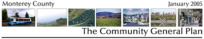
|
Vision Statement
The common goal for the Carmel Coastal Planning Area must be that any future development on existing legal lots of record blend with and be clearly subordinate to the natural scenic character. In considering developments on existing legal lots of record, a standard of “minimal visibility” will subordinate those developments to the existing natural grandeur.
Regarding style, when Buckminster Fuller visited the Monterey Peninsula, he recommended that new architecture should be invisible. Preservation of existing character should carry over into new construction. Any and all changes should indicate attachment to the existing character of the area.
The desired vision for the future of the Carmel Coastal Planning Area is that development during the next twenty years retains the existing character of our area. Development of existing legal lots of record must require strict adherence to general plan directives, to retain its current forested and rural character. The trees, the rural twisty road, the cliffs, the meeting of land and sea, and the vistas along the Pacific Ocean, must be preserved for generations to come. The challenge is to protect the quality of life and treasures of this area while continuing to provide needed housing for its workforce.
The importance of Highway One must be emphasized. Any development and widening plans for the roadway would damage the existing visual qualities of this scenic corridor, and seriously intrude into and alter adjacent neighborhoods. The general character of the Highway One corridor should be preserved in a rural and natural manner.
Of special note is the importance of the Point Lobos Reserve, the Crown Jewel in the California State Parks system. Care must be taken by Monterey County to retain the natural characteristics of the Reserve. Any development adjacent to the Reserve, or within the viewshed of the Reserve, must be carefully monitored and held to State Park General Plan policies. It cannot be over-emphasized that this remarkably unusual and beautiful Reserve must be protected, and the County must work with, and be supportive of the California State Parks Department, to achieve this objective.
Special Policies for the Carmel Coastal Planning Area
Carmel Coastal Policy #1 – Conflicting Land Uses
Intensive recreational uses such as golf, cinemas, mechanized recreation other than non-motorized bicycling and scenic driving, boating facilities; industrial and energy development - offshore or onshore; large-scale mineral extraction and commercial timber harvesting; and manufacturing other than cottage industry or art production are inappropriate and conflicting land uses in the Carmel Coastal area. Only land uses of a scale or level consistent with the goal of preserving the coast’s natural beauty and tranquility shall be considered.
Carmel Coastal Policy #2 – Highway 1 Development
Land uses in the Highway 1 corridor related to and dependent on the highway shall first and foremost preserve and protect the State of California’s Point Lobos Reserve, the Highway 1 scenic corridor, and the surrounding scenic areas.
Carmel Coastal Policy #3 – Commercial Uses
Commercial uses existing as of the date of adoption of this General Plan may continue in their present use or, if discontinued, another commercial use of the same nature shall be allowed upon being granted a use permit. If no other similar commercial use is proposed, then the property shall revert to single-family residential use.
Carmel Coastal Policy #4 – Recreation Uses
Recreation uses in the Carmel Coastal Area shall be limited to passive and low-intensity day-use recreational and educational activities consistent with the policies and recommendations of the California State Parks General Plan and with the policies set forth in this Plan. These areas include the Carmel Point shoreline, Carmel River State Beach, the marsh and lagoon, Point Lobos State Reserve, and the Garrapata State Park
Carmel Coastal Policy #5 – Visitor-Serving Facilities
Recreation and visitor-serving facilities should be of a scale and nature that make them compatible with the natural and scenic character of the area. Proposals for development of new visitor-serving facilities, or expansion of existing recreation and visitor-serving facilities, should be evaluated on a case by case basis. All proposals must demonstrate consistency with the land use plan, and environmental, visual, design and traffic safety requirements. Recreational vehicle campgrounds, additional grocery stores, and new service stations are not appropriate in the Carmel Coastal area, and shall not be permitted.
Carmel Coastal Policy #6 – Overnight Camping Facilities
Overnight camping facilities in the Carmel Coastal area shall be located where they do not conflict with surrounding land uses and where a buffer can be provided adequately to minimize potential land use conflicts.
Carmel Coastal Policy #7 – Height Limits and Design
In order to provide for more visually compatible structures, new structures along Scenic Roads in the Carmel Point and Carmel Meadows areas shall be limited to a maximum height of to 18 feet from the natural average grade. To ensure protection of the viewshed, the maximum height of structures in the Carmel Meadows area, including the Portola Corporation and Williams properties, shall also be limited to 18 feet measured from natural average grade. To ensure that new development in the Yankee Point area remains subordinate to the visual resources of the area, and to ensure that visual access from Highway 1, Yankee Point Drive, and Mal Paso Road is protected, the height limit in the Yankee Point area of Carmel Highlands-Riviera, for all properties seaward of Yankee Point Drive, and for all properties with frontage along the east right of way line of Yankee Point Drive that face such properties seaward of Yankee Point Drive, shall be 20 feet from natural average grade. The height limit for all other properties in the area shall be 26 feet.
In addition to such height limits, new development shall be subject to design guidelines, to be adopted by the Planning Commission for the Yankee Point area. These guidelines shall require that the visibility and design of structures in the Yankee Point area preserve and protect, to the maximum extent feasible, public visual resources.
Carmel Coastal Policy #8 – Carmel Mission
Because of the historical significance of the Carmel Mission, the Carmel Area Wastewater District, in using its land between the Carmel Mission and the Carmel River, shall not intrude on the integrity of the Mission grounds. Access to its land must be over the existing roadway.
Carmel Coastal Policy #9 – “Flatlands”/Riley Property
Most of the property is this vicinity has been acquired by the Big Sur Land Trust and will be transferred to the State Parks Department. Additional public or land trust acquisition of existing lots in this area is encouraged. Development on existing legal lots of record in this area shall be based on an adaptive reuse of existing structures, or shall be located out of view of Highway 1.
Carmel Coastal Policy #10 – Point Lobos Ranch
Priority shall be given to protecting the ranch’s scenic, natural and cultural resource values, including the present and former Hudson and Riley properties, in order to facilitate protection and management of most of the area as a unit of the State Park System. The following development standards, in addition to other applicable development standards shall govern the types and intensities of allowable uses on the ranch:
a. |
Improvements on State Park lands shall be limited to development of trails and improvements of existing facilities to accommodate visitor use, park support facilities and appropriate resource management.
|
b. |
Accommodations to support visitor use on the State Park lands shall involve adaptive reuse of existing structures.
|
c. |
Development on private property within the ranch shall be limited to one single-family residence per legal lot of record.
|
d. |
All overnight visitor-serving accommodations authorized on public or private property within the ranch shall be limited to low or lower cost accommodations.
|
e. |
Conversion of existing or new residences to bed and breakfast facilities within the ranch shall be prohibited.
|
f. |
Expansion of existing residences shall be limited in size to a maximum of 5,000 square feet of lot coverage including the residences, garages, guest quarters and all other structures.
|
g. |
The maximum height of new residences shall be 20 feet to the highest point of the structure as measured from the original grade of the site.
|
h. |
Construction shall be sited and designed so as to not be visible from public viewing areas including but not limited to State Highway 1 and Point Lobos State Reserve.
|
i. |
No development within the ranch shall be permitted which has significant adverse impacts on environmentally sensitive habitats. |
Carmel Coastal Policy #11 – Mission Ranch
Mission Ranch - The following specific policies shall regulate uses within the Mission Ranch. Any development on the Mission Ranch shall be conditioned to preserve wetlands.
a. |
The existing commercial/visitor serving facilities on Mission Ranch (other than the dance hall), consisting of the 26 visitor serving units, restaurant, tennis club and caretaker’s unit, may be allowed expansion to a maximum of 31 units, subject to securing a Coastal Development Permit and meeting the goals and policies of this General Plan, including those special policies applicable within the Carmel Coastal Planning Area.
|
b. |
The total area of any new Mission Ranch visitor-serving unit shall not exceed 500 square feet.
|
c. |
A Historical Resources designation shall be added to protect the important historic buildings.
|
d. |
The dance hall may be granted a use permit which allows for its continued use, but subject to reasonable conditions restricting hours of operation and providing for parking and traffic control, noise controls, and other controls, as appropriate, reasonably to mitigate adverse impacts on the surrounding residential neighborhood. |
Carmel Coastal Policy #12 – Palo Corona Ranch
In order to protect the high scenic values of the Palo Corona frontal slopes, no development shall be allowed within the public viewshed.
Carmel Coastal Policy #13 – Odello Property
Consistent with the 1996 State Parks amendment to the Carmel River State Beach General Plan, the 155-acre Odello West property (located west of Highway 1), formerly in agricultural use, shall be maintained as riparian and wetland habitat. This habitat area will act as a floodway, providing increased flood protection for the Mission Fields and Crossroads areas and to increase populations of special status species. The 100-acre Odello East property (located east of Highway 1) shall also be maintained as a floodway and habitat and/or agricultural open space.
Carmel Coastal Policy #14 – Highway 1 Policies
The overall objectives for Highway 1 shall be to keep Highway 1 south of the Carmel River a two-lane road, rural in character, with improvements subordinate to and blended into the natural scenic environment, and to maintain the highest possible standards of scenic quality in management and maintenance activities carried on within the right-of-way. Preserving and protecting Point Lobos Reserve, the Highway 1 scenic corridor, and the surrounding scenic areas are of particular concern. All improvements to Highway 1 shall be clearly subordinate to and shall blend into the natural scenic character of the area.
Carmel Coastal Policy #15 – San Jose Creek Beach
The County shall encourage the State Department of Parks and Recreation to investigate the potential of providing a restroom with shower near the proposed new parking lot for San Jose Creek Beach. Both the parking area and restrooms shall be sited and designed to protect the visual amenities of the area.
Carmel Coastal Policy #16 – Highway Shoulder Parking
Parking along the highway shoulders in the vicinity of major recreational areas shall be discouraged due to pedestrian and traffic hazards and conflicts. However, highway parking may continue until an alternative is constructed. Immediately upon completion of adequate new off-street parking, parking along the highway shoulder shall be prohibited. Parking prohibitions should be rigorously enforced, and appropriate structural barriers are permitted if necessary to deter illegal parking.
Carmel Coastal Policy #17 – Access Priorities
Important major access areas to be retained for long-term public use are: the Scenic Road corridor along Carmel Point, Carmel River State Beach and Point Lobos State Reserve. Access to the Carmel Highlands-Riviera area shall be provided by vehicular access on Highway 1, Yankee Point Drive and Spindrift Road.
Carmel Coastal Policy #18 – Scenic and Natural Resources
In areas of existing or potential public access where habitat and resource protection are identified as a major concern, studies should be conducted by qualified individuals or agencies to determine maximum acceptable levels of public use and methods by which resource values can best be protected. The conclusions of these studies should guide management of public access at such locations. To this end, the State Department of Parks and Recreation should give priority to the implementation of the resource-monitoring program for Point Lobos Reserve, as recommended by the State Park's General Plan for the area.
Carmel Coastal Policy #19 – Scenic Viewing Corridors
Existing visual access from scenic viewing corridors (e.g., Highway 1, Scenic Road, Spindrift Road, Yankee Point Drive) and from major public viewpoints, and future opportunities for visual access from the frontal ridges east of Highway 1 shall be permanently protected as an important component of shoreline access and public recreational use.
Carmel Coastal Policy #20 – Public Access Policies
Public access to and within Point Lobos State Reserve and Carmel River State Beach shall be consistent with State Park General Plans as well as consistent with this County General Plan.
Carmel Coastal Policy #21 – Carmel River Lagoon/Marsh
The County shall encourage the State Parks and Recreation Commission to expedite designation of the Carmel River Lagoon/Marsh as a Natural Preserve as provided by the California State Parks Carmel River State Beach General Plan. Public access should be restricted to this sensitive wildlife habitat and should not be allowed within the marsh.
Carmel Coastal Policy #22 – Water Quality Protection
Water quality in the Carmel River, other coastal streams and riparian corridors, and in the Point Lobos and Carmel Bay Areas of Special Biological Significance, shall be protected and maintained. The siting and design of improvements to public access areas shall be accomplished in a manner compatible with these sensitive resources. Similarly, private water supplies shall be protected by locating accessways an adequate distance from surface water, springs, and wells.
Carmel Coastal Policy #23 – Wildlife Corridors
To allow for wildlife movement from one open space area to another, adequate corridors (greenbelts) connecting open space areas must be maintained or provided. Such a corridor shall be specifically retained for movement of wildlife to and from uplands east of Point Lobos State Reserve and within the Reserve itself.
Carmel Coastal Policy #24 – Forest Management
Forest Management – Commercial timber harvesting shall be considered an inappropriate activity in the Carmel Coastal Planning Area. Priority shall be placed on environmental resource protection and avoidance of land use conflicts with the rural residential characteristics of the area.
Carmel Coastal Policy #25 – Redwood Forest Habitat
In recognition of its function as riparian habitat and of its important role in watershed protection, redwood forest habitat in the Carmel Coastal area should be retained as open space through encouragement of voluntarily dedicated conservation easements, or, where feasible, fee acquisition by public or non-profit resource conservation and management agencies.
Carmel Coastal Policy #26 – Gowen Cypress Habitat
Development proposed near Gowen Cypress habitat shall be set back a minimum of 100 feet to protect this sensitive resource. No development shall be allowed in this buffer area, and the natural vegetation shall be retained.
Carmel Coastal Policy #27 – Forest Restoration
Public agencies and Carmel Coastal area residents are encouraged to engage in native forest restoration activities as a means of maintaining and enhancing the Carmel area's natural character. Removal of non-native tree species is encouraged except where such vegetation provides important wildlife habitat.
Carmel Coastal Policy #28 – Retention of Snags
The restoration of Northern Coastal Prairie habitat in Point Lobos State Reserve should provide for the retention of snags along the ecotone and within the area to be converted to prairie.
Carmel Coastal Policy #29 – Instream Flows
Instream flows to the waterways within the Carmel Coastal Planning Area should be protected in order to maintain the natural plant community and fish and wildlife. Per the Carmel River Flood Control Ordinance regulations, the Carmel River shall be managed to allow instream flows to be sufficient to protect and maintain riparian vegetation, fishery resources and adequate recharge levels for protection of groundwater supplies, in addition to control of water levels in the Carmel River lagoon for flood protection purposes.
Carmel Coastal Policy #30 – Lagoon and Marsh
The County shall assist the maintenance and protection of the Carmel River lagoon and marsh by encouraging the retention of sufficient instream flows and controlling erosion and sedimentation from surrounding and upstream areas. The County shall encourage habitat and floodplain restoration efforts in the Odello Special Treatment Area.
Carmel Coastal Policy #31 – Key Public Viewshed Policy
To protect the scenic resources of the Carmel Coastal Planning Area in perpetuity, all future development within the public viewshed must harmonize and be clearly subordinate to the natural scenic character of the area. The design and siting of structures, whether residential, commercial, agricultural, or public, and the access roads thereto, shall not detract from the natural beauty of the scenic shoreline and the undeveloped ridgelines and slopes in the public viewshed.
Carmel Coastal Policy #32 – Public Viewshed Locations
Many of the Carmel area's visual resources are highly sensitive by virtue of their prominence in the viewshed as well as their unique scenic quality. These include: the rocky promontories, sandy beaches, and bluffs of the immediate shoreline, the open Palo Corona slopes, the Carmelite Monastery and forested slopes, the rural pasturelands south of San Jose Creek Beach, Point Lobos Ridge, and the ridge top immediately south of Point Lobos Ridge and Gibson Creek. The high visibility of these features from numerous public viewpoints and scenic corridors render them particularly important scenic resources of the Carmel area. In the following special policies for the Carmel Coastal Planning Area, the term “viewshed” or “public viewshed" refers to the composite area visible from major public use areas including Seventeen Mile Drive views of Pescadero Canyon, Scenic Road, Highway 1 and Point Lobos Reserve.
Carmel Coastal Policy #33 – Highway 1 Forest Corridor
The existing forested corridor along Highway 1 shall be maintained as a scenic resource and natural visual screen. Development along Highway 1 shall be sufficiently set back to preserve the forested corridor effect and minimize visual impact.
Carmel Coastal Policy #34 – Slopes and Ridgelines
New development on slopes and ridges within the public viewshed shall be sited within existing forested areas or in areas where existing topography can ensure that structures and roads will not be visible from major public viewpoints and viewing corridors. Structures shall not be sited on non-forested slopes or silhouetted ridgelines. New development in the areas of Carmel Highlands and Carmel Meadows must be carefully sited and designed to minimize visibility. In all cases, the visual continuity and natural appearance of the ridgelines shall be protected.
Carmel Coastal Policy #35 – Design for Minimal Visibility
In siting and design of construction in the Carmel Coastal area, consideration shall be given for the sharing of views from all properties in the area in terms of siting, bulk and height of new structures to the maximum extent feasible. The portion of a parcel least visible from the public viewshed shall be considered the most appropriate site for the location of new structures. Consistency with other Plan policies must be considered in determining appropriate siting.
Carmel Coastal Policy #36 – Design Review
To protect both scenic quality and visual access to the shoreline, the County shall conduct design review of all new structures or modification of existing structures in the Carmel Coastal area, except minor remodels of existing structures and new accessory structures of a minor nature that have minimal to no impact on coastal resources. Landscaping plans shall also be required and reviewed by the County as a secondary protection of scenic resources.
Carmel Coastal Policy #37 – Siting and Design Measures
The following siting and design control measures shall be applied to new development to ensure protection of the Carmel Coastal area's scenic resources, including shoreline and ocean views:
a. |
On ridges, buildings shall be sufficiently set back from the precipice to avoid silhouetting and visual obtrusions. Buildings located on parcels containing slopes shall be sited on existing level areas and sufficiently set back from the frontal face of the slope area.
|
b. |
New development shall be designed to blend into the site and surroundings. The exterior of buildings must give the general appearance of natural materials (e.g., buildings should be of weathered wood or painted in “earth” tones). The height and bulk of buildings shall be modified as necessary to protect the viewshed.
|
c. |
Exterior lighting shall be adequately shielded or shall be designed at near-ground level and directed downwards to reduce its long-range visibility.
|
d. |
Existing trees and other native vegetation should be retained to the maximum extent possible both during the construction process and after the development is completed. Landscape screening may be used wherever a moderate extension of native forested and chaparral areas is appropriate. All new landscaping must be compatible with the scenic character of the area and should retain existing shoreline and ocean views. |
Carmel Coastal Policy #38 – Visual Access
Visual access to the shoreline from major public viewing corridors and residential roads in Carmel Highlands-Riviera should be protected for visitors and residents alike.
Carmel Coastal Policy #39 – West Side of Highway 1
New structures and landscaping on existing legal lots of record on the west side of Highway 1 shall be sited and designed to retain public views of the shoreline from Highway 1 and roads seaward of the highway.
Carmel Coastal Policy #40 – State Park Planning
The County shall encourage the State Parks Department to provide for retention of the area's scenic character and visual access from Highway 1 in the Point Lobos and Carmel River State Beach General Plans.
Carmel Coastal Policy #41 – Utilities in the Viewshed
Existing power lines running along Highway 1 between Point Lobos Reserve and Malpaso Creek and along San Jose Creek Beach should be re-routed out of the viewshed or placed underground where feasible. New overhead power or telephone lines will be considered only where overriding natural or physical constraints exist. Where permitted, poles will be placed in the least conspicuous locations out of public, and where possible, private view. Television antennas and ham radio facilities shall be unobtrusive. Water lines and drainage pipes should be buried or otherwise obscured by vegetation.
Carmel Coastal Policy #42 – Signage
Commercial signage shall be limited. Signs on private property along Highway 1 shall be constructed of natural materials or wood, and shall be unpainted, except for lettering. Signs shall not be internally illuminated. No neon or animated advertising signs will be allowed inside windows or outdoors.
Carmel Coastal Policy #43 – Water Wait List
The County shall establish and update procedures to process permits for new homes or other uses that require water, on a vacant legal lot of record located within the Monterey Peninsula Water Management District (MPWMD). Potential permit applications shall be considered in accordance with the requirements of MPWMD and in the order listed on the County Water Wait List.
Carmel Coastal Policy #44–Commercial Water Allocation
The County shall utilize the established MPWMD commercial water limit of 0.41 acre-feet in determining water allocations for commercial projects.
Carmel Coastal Policy #45 – Wastewater
The County shall support wastewater disposal systems and the establishment of water quality management and monitoring programs designed to protect and maintain a high level of water quality in the Carmel River Lagoon, the Carmel Bay Area of Special Biological Significance and Ecological Reserve, and in the Carmel area’s coastal streams. Use of treated wastewater to enhance the lagoon’s water quality and volume should be encouraged.
|