Area Plans – Toro |
|
A PDF version of this page is available here: 26ToroAreaPlan.pdf |
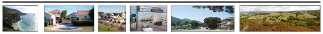
Of all of the Planning Areas in Monterey County, Toro is perhaps the most changed in the past twenty years. Land use patterns have been altered as grazing land has been converted to residential development. The previous pattern consisting of scattered homes throughout a rural grazing area has made way for more intensive residential uses. There are important visual elements that give Toro its identity. Native trees, ridgelines and frontal slopes, historic sites and the quality of darkness must be preserved and protected by County policy. The scenic beauty of road corridors, especially Highway 68 and River Road, must be safeguarded. Parks and open spaces should be used as the central planning focal point. These parks and open spaces must be preserved for their recreational, wildlife habitat and water management values. Toro residents have expressed their continued commitment to protecting the scenic resources of the area. Many residents fear that allowing further growth before addressing existing needs and infrastructure deficiencies will undermine the beauty and peaceful lifestyle of the area by placing additional demands on already strained infrastructure conditions and public safety services. Toro’s proximity to the Monterey Peninsula and Salinas, its rural atmosphere, mild warm climate and scenic open space, have made it an area that has been attractive for residential development. The presence of oaks, large native sycamores, lupine and other wildflowers has also provided a scenic quality that has attracted both residents and visitors. Steep slopes, erosion and fire hazards, prevalent throughout much of this 74 square mile Planning Area, however, have limited residential development primarily to the road corridor areas along the valley floors and canyons. State Highway 68 and Laureles Grade Road, a major corridor between Highway 68 and Carmel Valley Road, are officially designated State Scenic Highways. Corral de Tierra, San Benancio, Corral del Cielo, and Underwood Roads are identified as scenic routes recommended for State Scenic Highway designations through this area of the county. In the River Road corridor, residential growth also has occurred, adding increased traffic volume to River Road and resulting in conflicts between residential traffic and farm vehicles. While efforts have been made to preserve the viewshed from scenic Highway 68, residential development is visible in some areas. Traffic volumes along the highway have also increased. As residential subdivisions have been added within the Toro area and adjacent Planning Areas, traffic on Highway 68 has reached a point where stop and go traffic is common during peak periods. Additionally, infrastructure development, including water availability in some areas, has not consistently kept pace with residential growth. The Toro Planning Area includes a large amount of public land and recreational open space including the Toro Regional Park and public lands within the former Fort Ord. The Laguna Seca Recreation Area is located adjacent to this Planning Area and contributes revenue to the County Regional Parks system, including Toro Regional Park. However, when major events occur at the raceway, weekend traffic loads have become a problem at visitor arrival and departure times. Additionally, residents have had issues with noise and the increase in outdoor lighting. All residents within the Toro Planning Area travel to the Salinas or Monterey areas for their major shopping and services. Elementary and middle schools are located in the Toro area, but students travel to high schools in other areas for secondary grades. The vision for this Planning Area is to remain rural in nature, with limited commercial uses. The existing pattern of development is a scattering of residential communities separated by topography and linked by Highway 68 and River Road. While many residents are willing to travel out of the Planning Area for employment, education, and basic goods and services, this travel requires vehicle trips on an already congested highway. Currently, events at county parks, the Laguna Seca Recreation Area and winery tasting rooms generate use of the highway by visitors and residents from outside the Planning Area. Possible future development of the winery industry in the River Road corridor, along with additional county events, would result in additional traffic impacts on River Road and Highway 68. The previous Toro Area Plan stated that infrastructure should be developed in coordination with development. This has not always occurred, as development has outpaced infrastructure construction. Many cumulative effects of growth have been identified but have not been quantified, nor have solutions been funded. The existing scattered, low-density development pattern and consideration of further development along River Road would pose a difficult challenge for providing public infrastructure and services, which is why this General Plan’s decision to direct new development largely to cities and Community Areas is a policy that will be of significant assistance in achieving the desired future for the Toro Planning Area. In order to preserve the rural and scenic nature of this area, to prevent further strain on infrastructure, to ensure that emergency response times are not further compromised, and to use limited county fiscal and other resources efficiently, the following policies are adopted for implementation in the Toro Planning Area.
Toro Policy #1 - Commercial Design Guidelines Toro Policy #2 - Prohibited Industrial Land Uses Toro Policy #3 – Greco Property Toro Policy #4 – State Highway 68 Improvements Toro Policy #5 – Toro Area Road Improvements Toro Policy #6 – Groundwater Toro Policy #7 – Scenic Corridors
Further Scenic Corridor Protection Planning is also recommended to correspond with the Highway 68 State Scenic Highway designation. Toro Policy #8 – Scenic Vistas Toro Policy #9 – Airport Noise Hazards Toro Policy #10 –Laguna Seca Area Noise Hazards |