| Home | Issues & Actions | About |
Archive Page This page is available as an archive to previous versions of LandWatch websites. |
LandWatch Releases Graphics on Development Plans
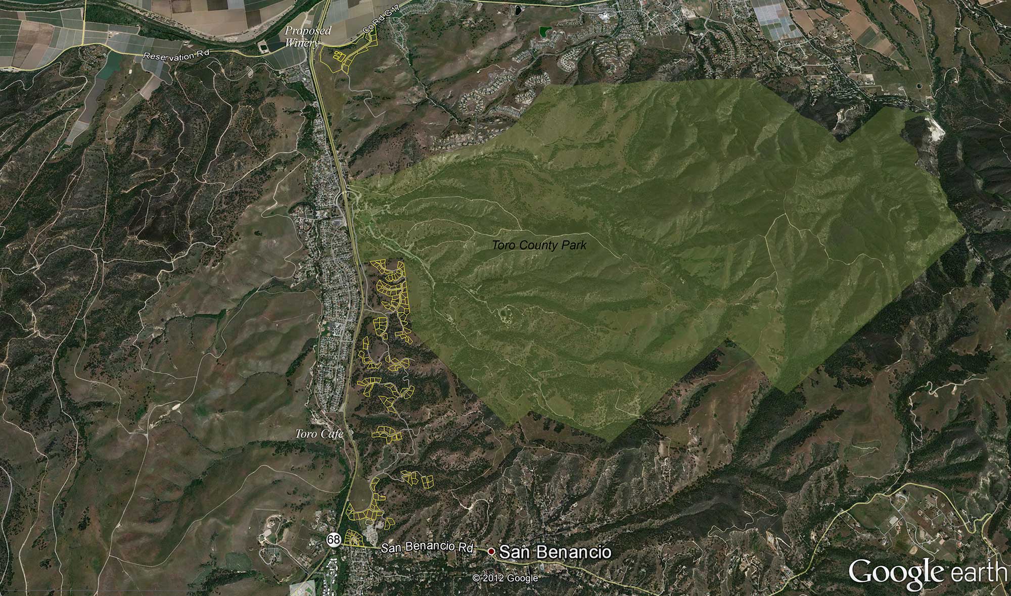
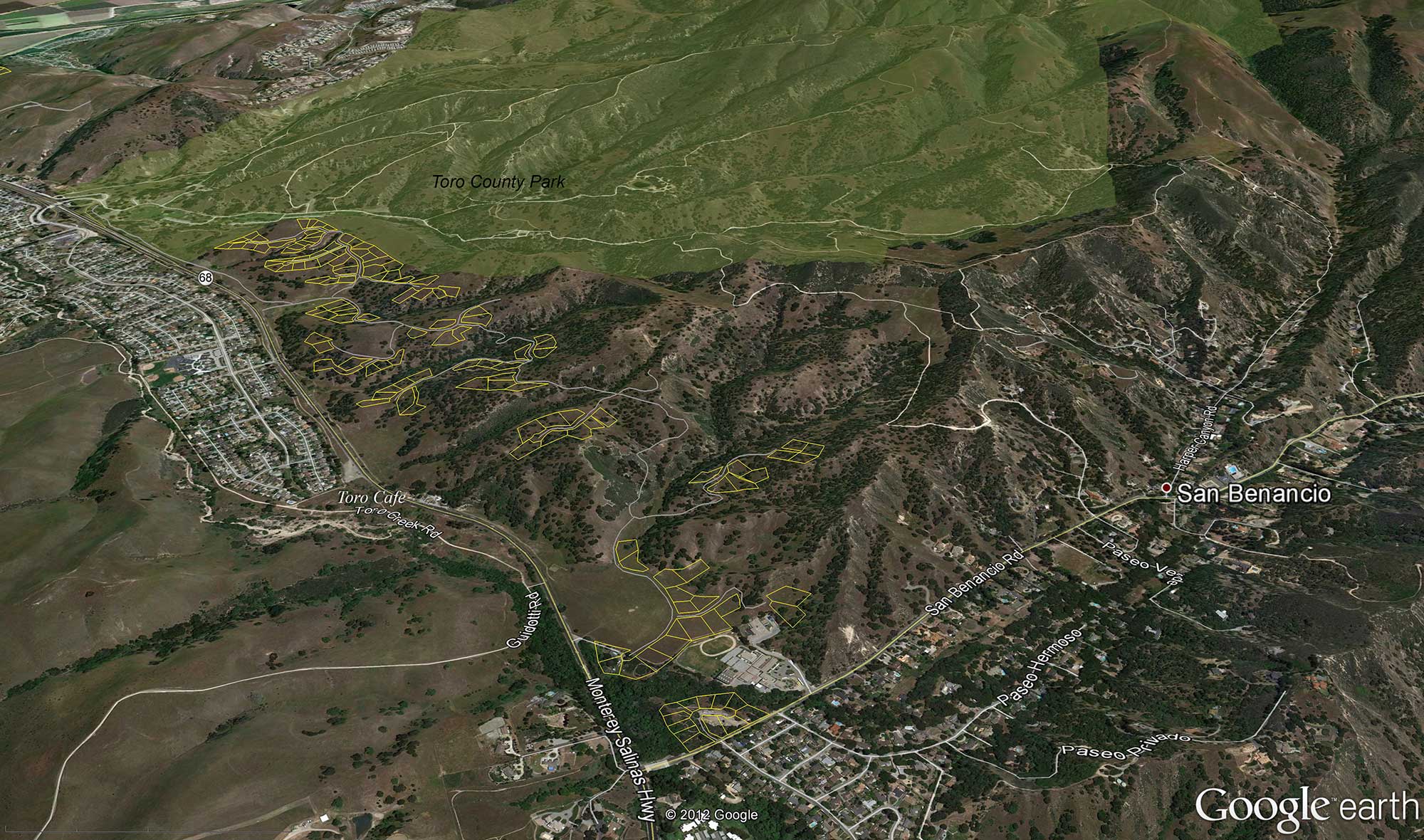
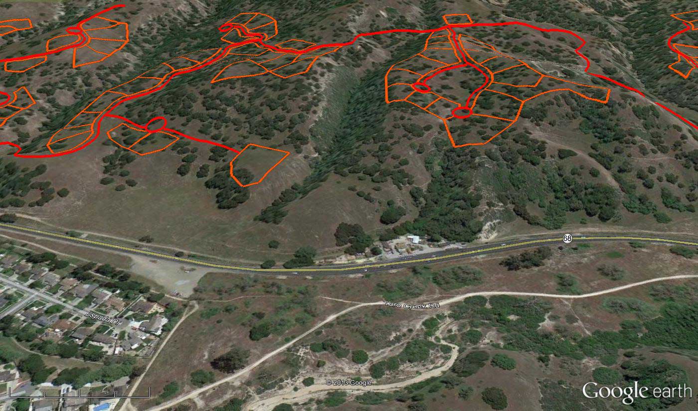
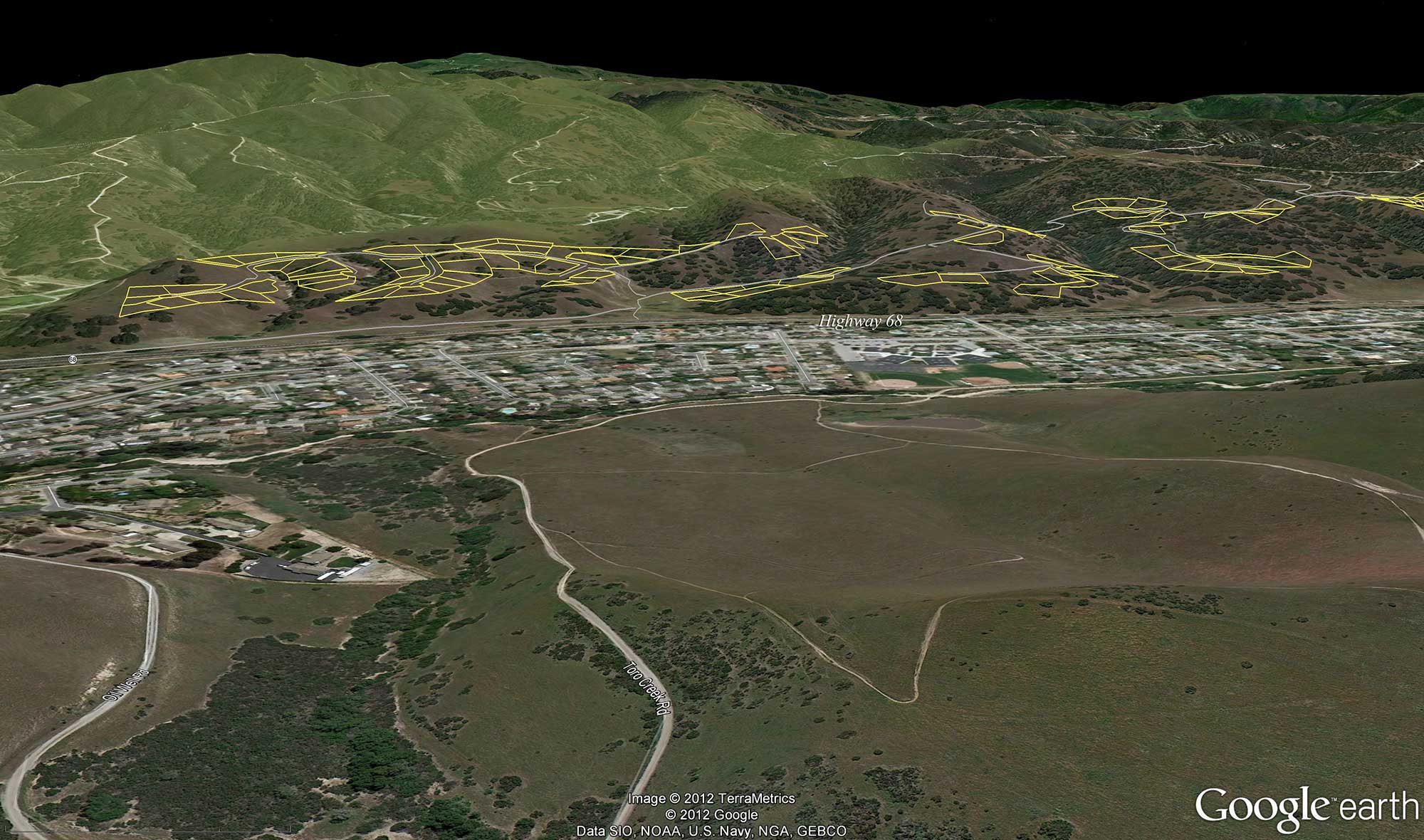
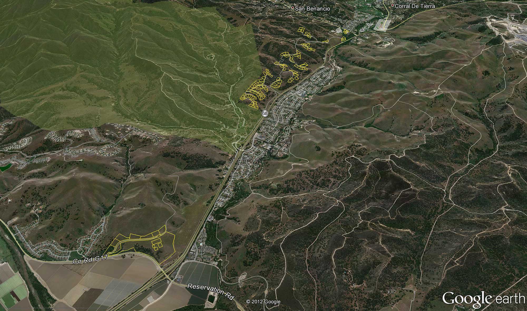
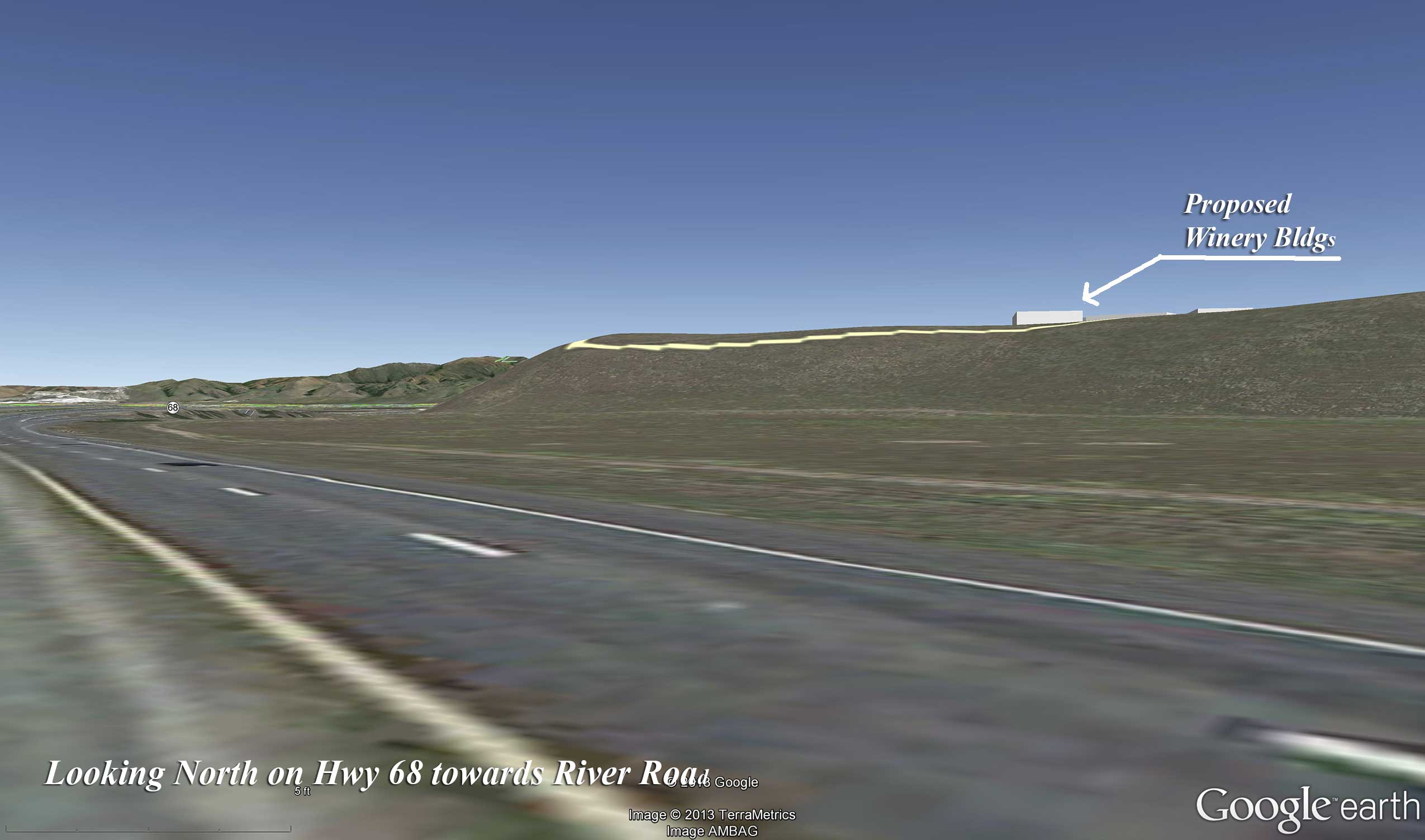
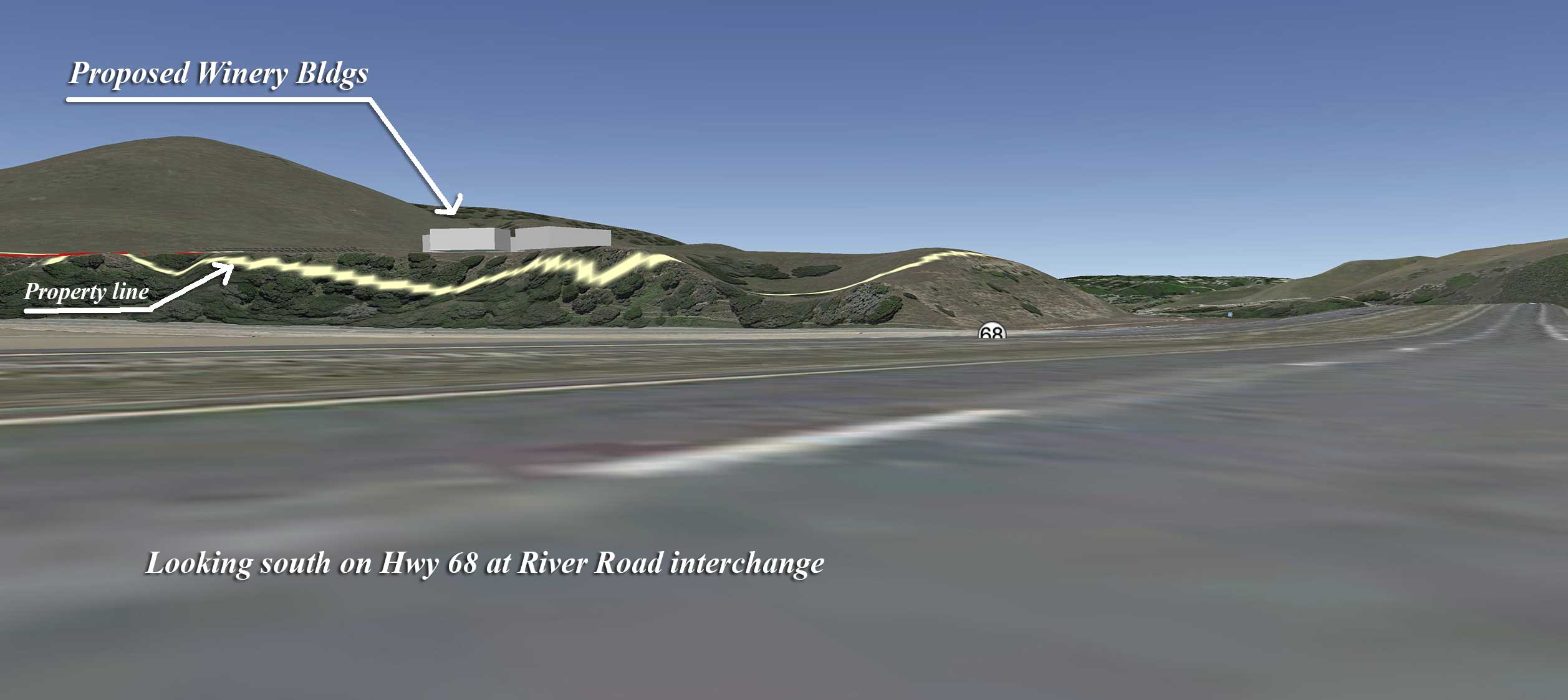
The following images represent aerial views of the property, using Google Earth, showing Ferrini Ranch’s relationship to existing communities, roads, parks, and the general area. The yellow lines represent the development lots within the project boundary and the green area is Toro County Park. (Click on the thumbnail images below to enlarge)
 |
|
Overview of Ferrini Ranch |
|
 |
 |
View from above San Benancio Road |
View from above Toro Cafe |
 |
 |
View of Ferrini Ranch Entry |
View of Ferrini Ranch Entry looking south |
 |
 |
View of Ferrini Ranch looking North from Hwy |
View of Ferrini Ranch’s Winery looking South across Hwy |
Draft Environmental Impact Report Comments
The Draft Environmental Impact Report (DEIR) was released and is available on the County website. Comments were due to the County by November 16th. True to form, LandWatch submitted 44 pages of substantive comments on the project proposal. Download the LandWatch comments (336K PDF file).
[Return to Ferrini Ranch Issues and Actions]
Posted 11.20.12
|
CONTACT 306 Capitol Street #101 PO Box 1876 Phone (831) 759-2824 Fax (831) 759-2825 |
|